 Click to enlarge
Fuel Hazard Mapping at the Interface.
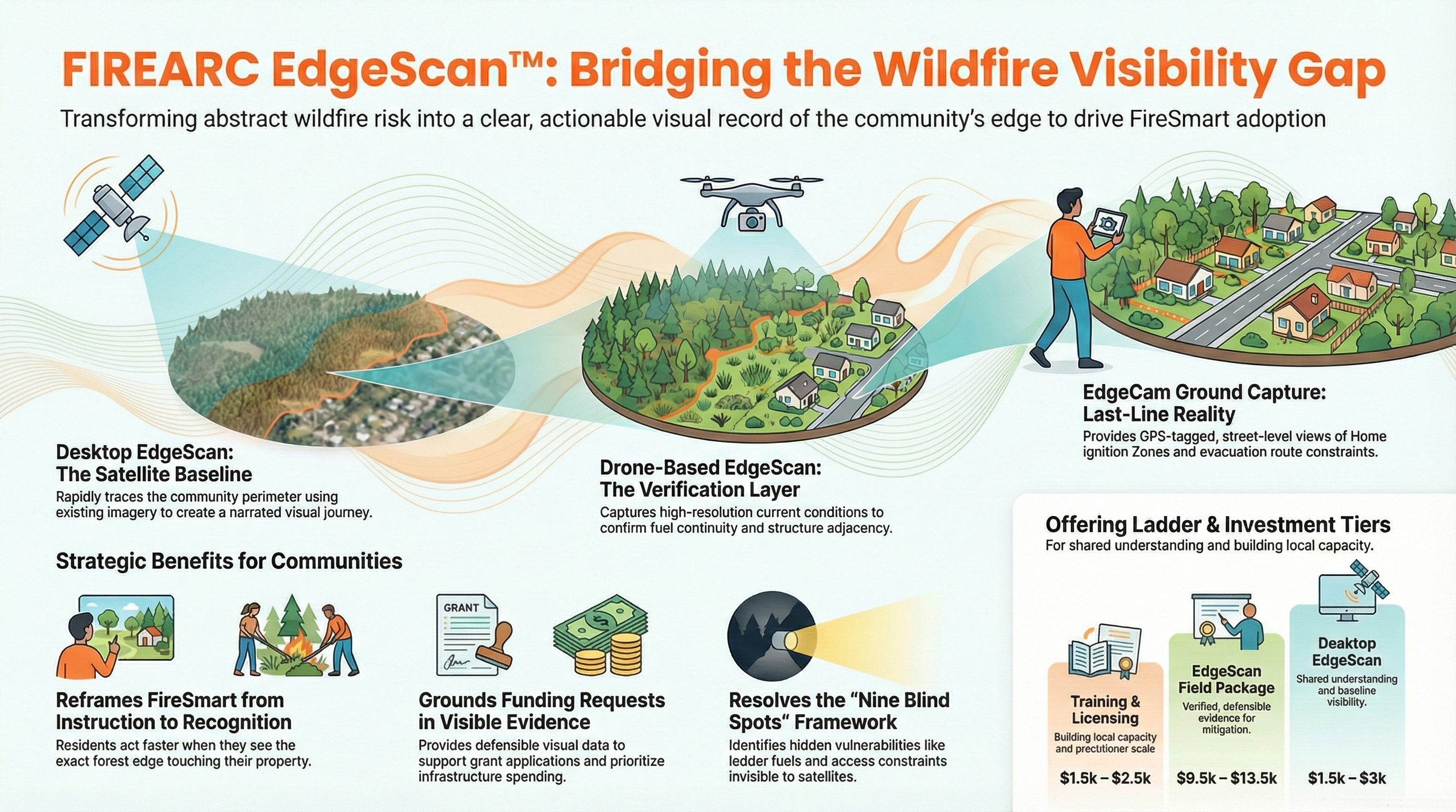
Where community meets wildland is where risk is highest and least understood. EdgeScan delivers visibility and analysis along the WUI perimeter, identifying the specific edge segments most likely to allow fire entry and conditions that amplify that risk.
This is designed to help activate FireSmart thinking. The Wildland-Urban Interface is not a uniform line. Fuel loads vary, vegetation structure changes, topographic features create funnels — and most community fire plans treat the entire perimeter as equivalent. EdgeScan disaggregates the edge to reveal which segments deliver maximum protective value when treated first.
Observation of the WUI perimeter producing a profile and action possibilities segment by segment.
Structural visibility assessment identifying perimeter segments with obscured lines of sight that reduce early detection capability and emergency response efficiency.
Combined with HaloScout directional analysis, EdgeScan identifies the specific perimeter entry points that sit within the highest-probability approach corridors. It tells us where we may want to focus action and education.
Complete WUI perimeter hazard assessment — segment-by-segment analysis, fuel hazard ratings, visibility scores, and priority treatment recommendations.