 Click to enlarge
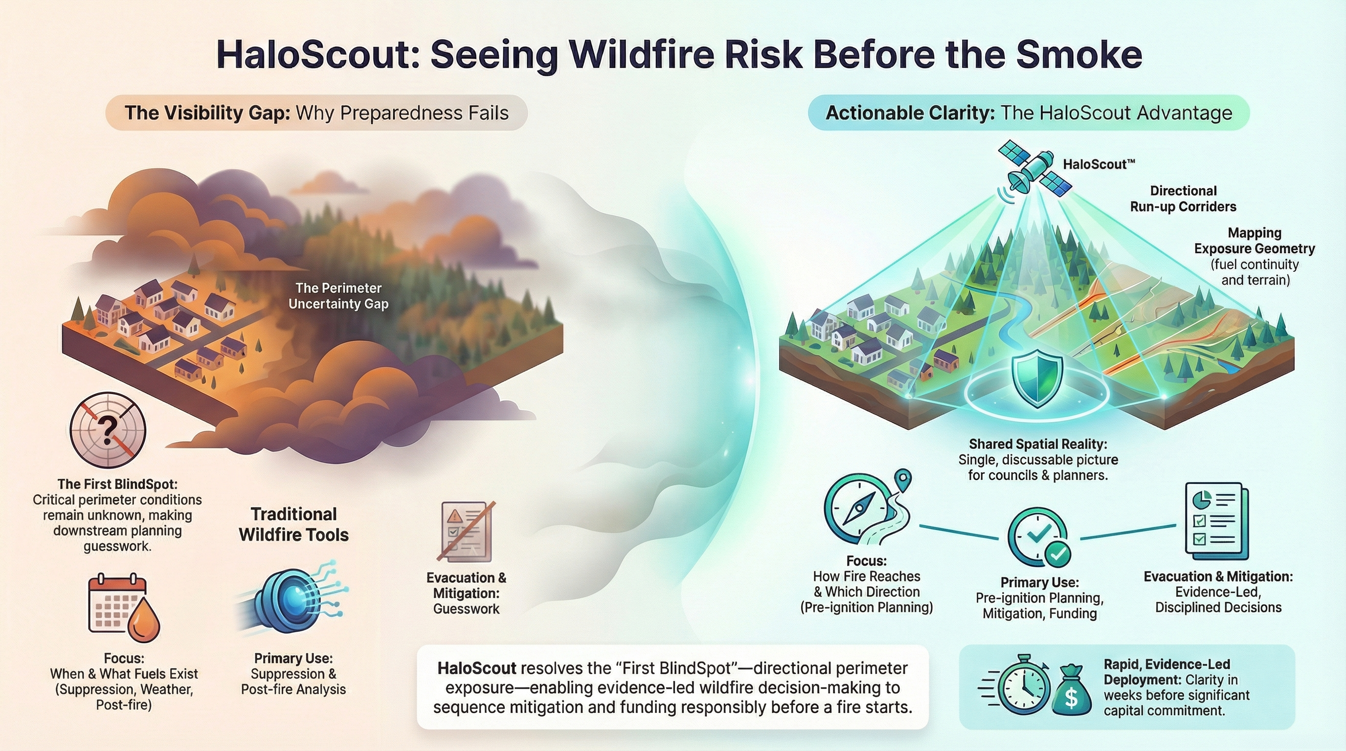
Directional Exposure Analysis from Above.
HaloScout identifies the 3 to 5 dominant fire approach corridors surrounding your community — the directions where fire is mathematically most likely to arrive. Stop planning for every direction. Start defending the right ones.
The visibility gap — the absence of pre-ignition directional exposure intelligence — causes communities to invest mitigation resources in the wrong locations. HaloScout eliminates that gap with satellite-derived directional analysis that tells you precisely which sectors require priority action.
Analysis built from verified satellite observations of fuel, vegetation density, and historical fire behavior — not assumptions.
Each HaloScout report delivers an 11-section analysis with directional exposure exhibits — a complete picture of your community's fire risk envelope.
Structured for immediate use in Council briefings, CWPP development, and capital budget planning. Not academic — operational.
Complete directional exposure intelligence packaged for decision-maker consumption — from dominant approach corridors to priority treatment zones.